
blah blah blah
Fort Mountain
Length: 2.3 miles out-and-backDifficulty (click for info): Easy
Elevation Gain: 660 feet (+30 feet on return)
Rating (click for info): 7/10
Elevation: 1413'
Promience: 828'
Driving Directions:
Trailhead and parking area are on Mountain Road in Epsom, NH. To get there, start from Rt. 28, 2.8 miles south of Rt. 202 at the Epsom Traffic Circle. Turn east onto Short Falls Road and proceed 1 mile to a four-way. Drive straight across onto New Rye Road and continue 1.1 miles, then take a left onto Swamp Road. After 1.5 miles, turn left onto Mountain View Road. Go 0.2 miles, bear right, and drive another 0.2 miles to a fork where the access road continues ahead and driveway and snowmobile trail are to the left. Find a place to park around the base of the driveway or on the roadside. Click here for a Google map.
About the Hike:
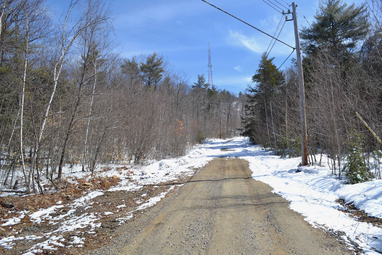
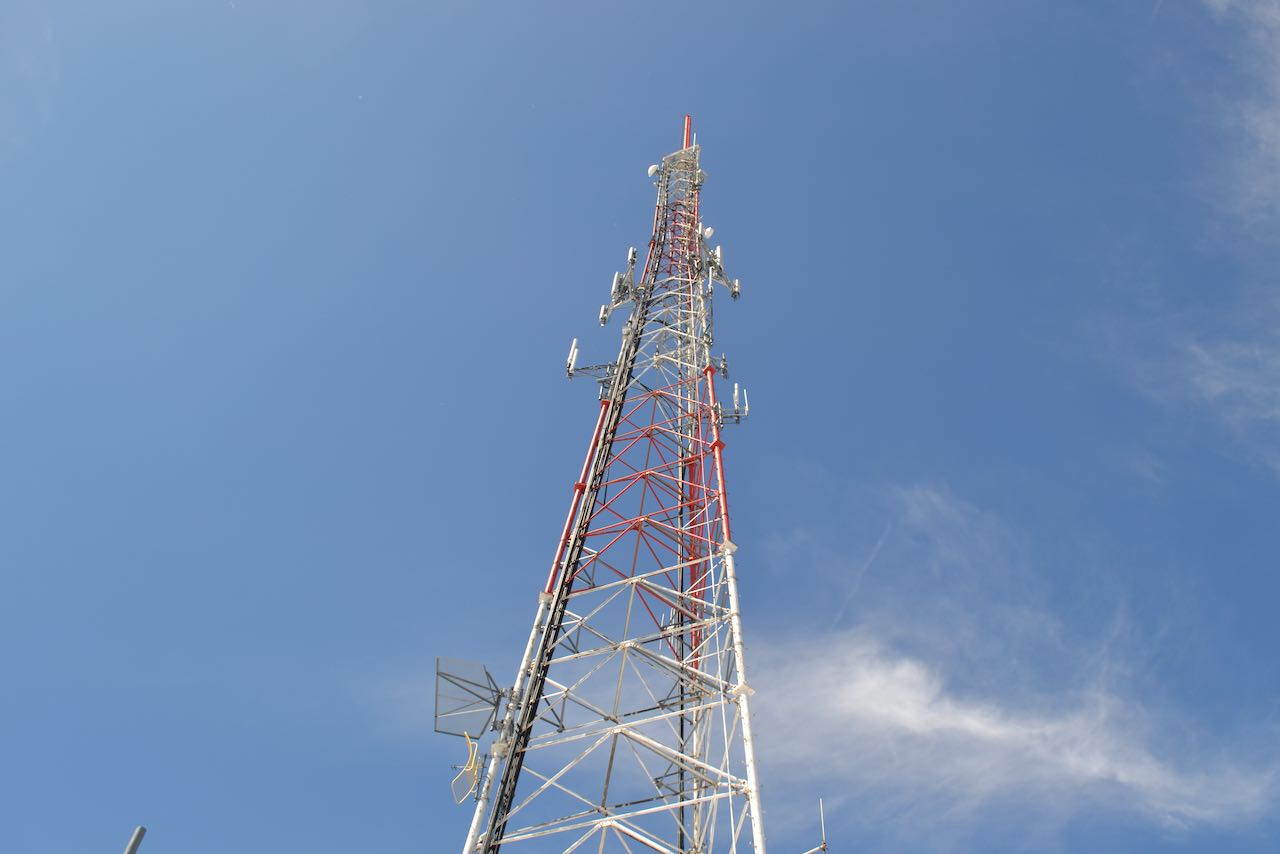
Although diminutive by New Hampshire mountain standards, the sub-1500' Fort Mountain rises over the flatlands of the southeastern region of the state, being the highest point in a 16.4-mile radius. This makes it the sixth most isolated mountain in all of New Hampshire, a fact that is still not enough to lift it to preeminent status with the hiking public. Unsurprisingly, a communications tower adorns its summit, taking advantage of its relative prominence. While this may diminish its beauty as a natural feature, the clearing allows for a tremendous view that is scarce in mountains of this size. It also eliminates the need for a dedicated hiking trail, as foot traffic is welcome on the cell tower access road, providing for a well-graded and smooth-surfaced walk to the summit.
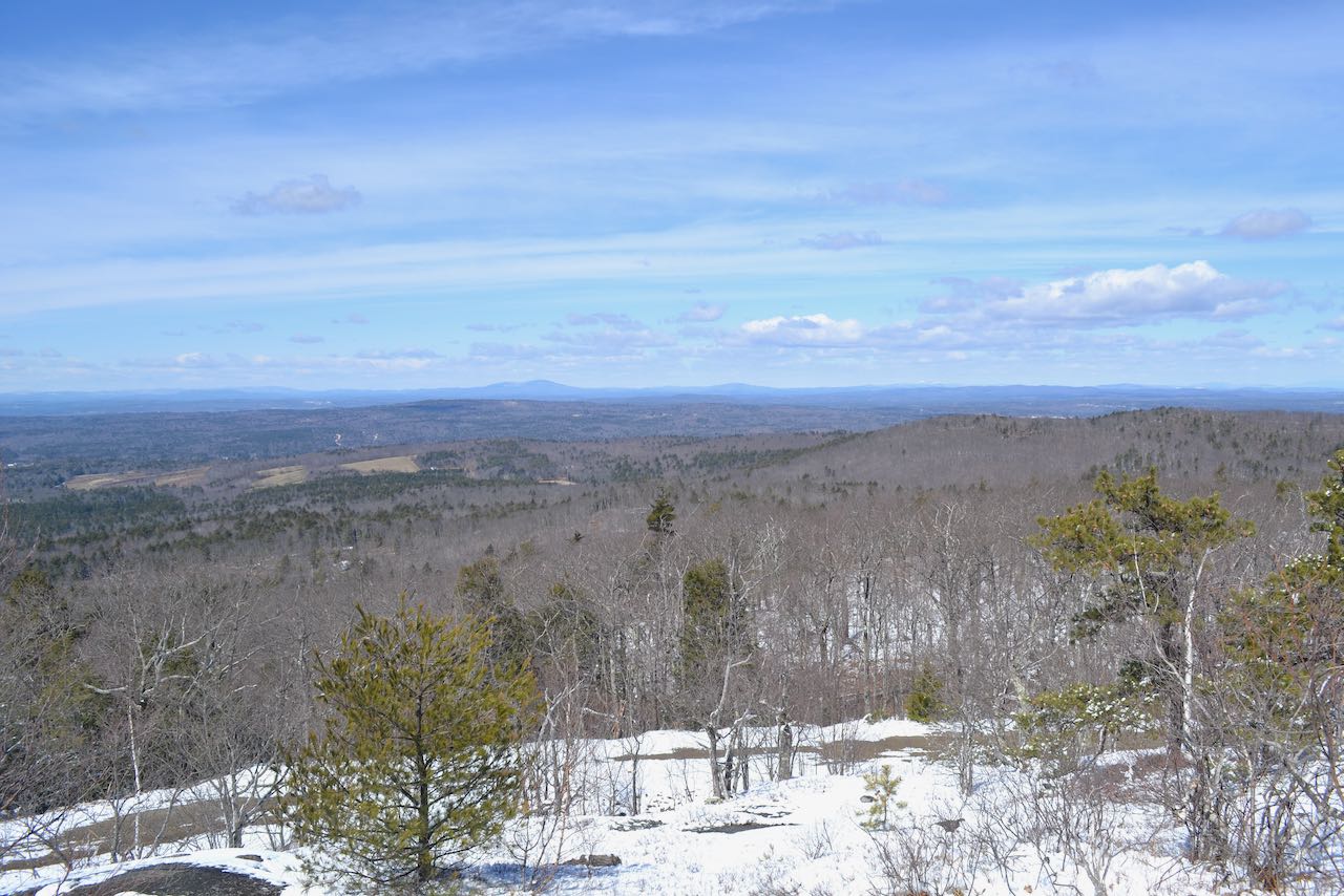
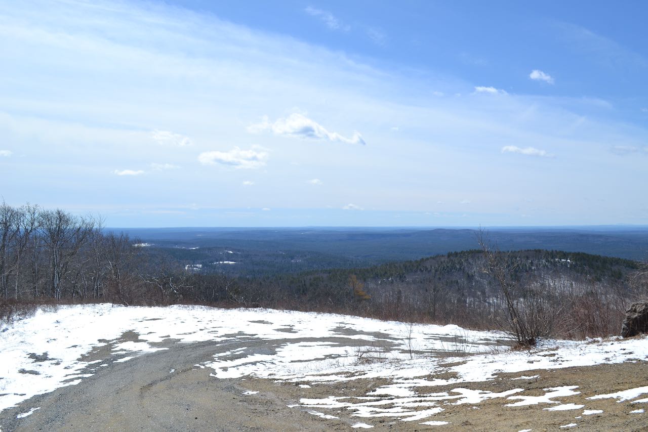
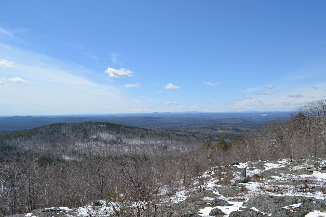
It is a straightforward walk of just over a mile up the gravel access road. It begins with a mostly flat stroll through the forest. Past the bar gate, the foliage opens up and you can see the cell tower at several points. As the slopes get steeper, the road curls into switchbacks to alleviate the incline. Approaching the summit is a hairpin turn, at the top of which wide views open up. The road makes a final jog up to the tower. Walk around to the opposite side of the tower to the uplifted ledge which forms the highest ground for the best single vista. The view is open in most directions over the treetops. North looks out to the profile of the White Mountains; the Belknap Range is seen in front. Off to the northeast the view takes in some of the Blue Hills in the southeastern region. Northwest is the area around Mt. Kearsarge. This view is enhanced with a good clear day, when many distant peaks reveal themselves. Additional views to the southeast, looking over to nearby Rockingham County highpoint Nottingham Mountain, can be found by following a faint path which drops into the woods at that last jog in the access road. This area of open ledges can be seen ahead through the trees. It opens up wider views toward southern peaks including Monadnock, Crotched, and out to Wachusset Mountain in Massachusetts.
Printable directions page